10.10.13

More from Sicily


I thought I should concentrate to two or three posts regarding my trip to Sicily and the Aeolian Islands. Finally, there will be this one and one more.

I rented a car and made a limited tour of Sicily, starting with…


… Syracuse, known for its Greek history, amphitheaters … and for the place where Archimedes was born, lived and died. It was once one of the major cities in the Mediterranean world. The Greek period was followed by Roman and Byzantine dominations interrupted by Muslim influence. During the mediaeval period, like for the rest of Sicily, there was a permanent influence struggle between different European dynasties, followed by the integration in the unified Italy (1865).

It was around Syracuse that the allied invasion of Sicily (Operation Husky) started in 1943.

The historic centre “Ortigia”, separated by the rest of the city by a canal, is dominated by the central place, Piazza de Duomo. The cathedral has still pillars from the time it was a Greek temple. During a first visit I was met by a very strong thunderstorm. I went back the following morning … under a blue sky.


On the hills behind the city centre, you can find what is left of an enormous Greek theatre (rebuilt by the Romans), a Roman amphitheatre…  An enormous cave, the “Ear of Dionysius”, so baptized by Caravaggio, once (built?) used as a water storage.
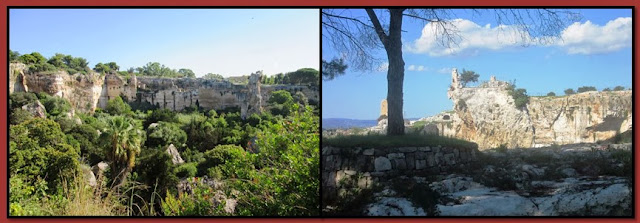


Further up the hill, behind a statue there are some old graves, supposed to be the burial place of Archimedes (287-212 BC).  I think we all learnt about him in school, but if you want to refresh your memory you can go here.  There is a very interesting Archimedes museum.


Next stop was at Caltagirone, especially known as a town of pottery. The origin of the name is acutally Arabic – “qai’at-al-jarar” – “Castle of the (potter) jars”.  The main landmark is the 142-step staircase, “Santa Maria del Monte” from 1608, with each step decorated with different ceramics.


Piazza Armerina…


… is actually best known for the nearby "Villa Romana del Casale", from the 4th century, containing the world’s largest collection of Roman mosaics. It was covered by a landslide during the 12th century. Excavations were made during the 20th century and it has been partly roofed for protection. Especially known are the “bikini girls”, young women performing different sports.


I then drove down to the southern coast, to Agregento…


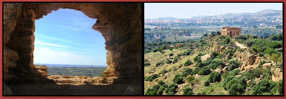
… renowned as the site  of the ancient Greek city Akragas. It was one of the richest and most famous Greek colonies, today known as the “Valle dei Templi” (Valley of the Temples).  They constitute some of the largest and best-preserved ancient Greek buildings outside Greece. One of the temples is surprisingly intact, thanks to its conversion to a Christian church in 597 (see picture on top of the post).


A little valley behind the temples is worth a visit for its luxurious vegetation.


Also, definitely worth a visit is the archeological museum, which in a remarkable way shows a collection of the rich findings on the site.


Here you can see the view I had from my hotel room - on top the total view of three temples - the some zooming.


7.10.13

Mount Etna


Mount Etna on the Sicily Island is the most important active volcano on the European mainland (although of course it’s on an island). (I explained the reason to the high volcanic activity in the region in my previous post about the Aeolian Islands.) Etna has some four or five main craters and a number of smaller ones. The slopes are covered with lava, some from very recent eruptions (also earlier this year). In more recent history the most known destructive eruptions took place during the 17th century when large parts of the city of Catania were destroyed; however obviously causing few casualties (the lava flows rather slowly). It’s however surprising to see the number of cities and villages on the flanks (the red spots on the map below), considering also the number of – mostly modest – earthquakes.


From the road on the way to the top you can see  some buildings which have been covered by lava.


From a parking place on the level of about 1 900 m (6 300 ft) you can use cable cars and then special terrain vehicles to reach the top…. and you can of course walk. The altitude of the mountain varies slightly according to new craters and eruptions but it’s approximately 3300 m (11000 ft.). It’s quite cold up here and there were still some traces of snow from last winter. (In winter it’s a popular place for skiing.)


There were of course clouds around, but walking down part of the slopes, we suddenly saw this old crater in some light – see also top picture.

Nature takes its right, vegetation starts slowly… (I wonder what this lady-bird found to eat) and finally the earth becomes very fertile. There were some foxes along the road.  


3.10.13

Aeolian islands


I’m back from a week around the Aeolian Islands and another week on the Sicily mainland. I could make a large number of posts about this trip, but I will try to limit to two (or three…?). After all, this blog is supposed to be about Paris. :-)

We are of course in a very volcanic area. Sicily is on the border between the African and Eurasian megaplates, actually on the African side. The African continental shelf is in constant movement towards Europe. On this map one can see the low water depths between Africa and Sicily (dry land some millions of years ago) and the deep waters of the Tyrrhenian and Ionian Seas.


Starting with the Aeolian Islands… They are the results of volcanic activity since some 260 000 years. There are still two active volcanoes – Stromboli and Vulcano. We made a lot of boating between five of the islands – Lipari, Vulcano, Salina, Panarea and Stromboli.


There are traces of human civilization since some 6000 years. Between the 6th and 4th centuries BC there was a Greek domination. Then the islanders were allies of the Carthaginians against Rome which led to a period of decadence and poverty, later followed by domination by Visigoths and Ostrogoths and by the Byzantine empire. Things improved by the arrival of Normans during the 11th century and links to France and Naples. Then came a Spanish domination via the “Kingdom of the Two Sicilies” (southern present Italy and Sicily). In 1544 a Turkish fleet led by Barbarossa occupied Lipari, the main island, and most of the inhabitants were enslaved. The Spanish then repopulated with Sicilian, Calabrian and Spanish families. Finally came the integration of the unified Italy during the 19th century.

Lipari is the largest of the islands with some 11 000 inhabitants. There have not been any reported eruptions since the 5th century.


The last great eruption on Vulcano took place 1888-90. The main crater is 500 m (1650 ft) above sea level. There is permanently some (partly sulfuric) smoke. Close to the beach you can find a mud (slightly sulfuric) bath.


Salina (the name of course from some previous salt production) is a quiet island – no eruption since some 13 000 years.


Among the islands, the most active volcano is to be found on Stromboli (see top picture). The last major eruption was in 2009, but there are permanently some minor eruptions and a lot of smoke.


The name of Stromboli is of course linked to the 1949 movie by Roberto Rosselini with Ingrid Bergman. You can see the little house where they lived.


I had the intention to climb to the 926 m (3 000 ft) top, but my Gauloise lungs and the recommendations by our guide made me give up half way. I learnt from the people who reached the top that they had seen “nothing” because of clouds. Normally some of the eruptions should be spectacular, but, unfortunately, later in the evening, the only thing I was able to photograph from a moving boat was a vague light among the clouds.


Panarea is the most “chic” island with well paved streets (for walking or for small electric cars, scooters…), white painted buildings and walls… the homes of all kinds of world celebrities who still somehow manage to “hide” here. To be seen are also the rests of a Bronze Age settlement, beautifully situated (Capo Milazzese).