3.4.14

The Temple area


In my last post about the “Carreau du Temple” I promised to revert with something more.

Despite the fact that I already wrote (see here) about the long history of this area, I cannot resist against some more history and mapping.

Just round the corner of the covered market, you can find some kind of wall map of what the area looked like in 1793, before some demolition was started. Some illustrations “stolen” on the net, show the aspect of what once was the home of the Templars by the end of the 18th century, when Louis XVI and Marie-Antoinette were imprisoned in the old tower / castle-keep. This tower stood just in front of where now the 3rd arrondissement Town Hall stands – see the blue marks on the pavement.  

I also made a comparison between today and the Turgot-plan from 1739 and with the city plan from 1790 (the tower encircled).


I amused myself by trying to incorporate these plans with the present look of Paris.

In the beginning of the 19th century the area was completely remodelled. We could then find the “Rotonde du Temple” (already there since 1788) and wooden covered markets were added early 19th century. This became an important centre for clothes and tissue merchants.


All this was replaced around 1863 and a vast area was covered by a steel, brick and glass complex, still specializing in the same trade. In this illustration from the end of the 19th century, we can see what it all looked like – including a new little park and the local Town Hall (3rd arrondissment).

Four of originally six pavilions were dismantled 1905 and today remain only the two we know. The space of the four disappeared ones is now occupied by some imposing, well decorated, official and school buildings from the early 19th century.


So, now coming to what we can see today. My previous post already described the remodelled covered market buildings. What is really attractive is the beautiful little park, Square du Temple, opened around 1860, once again thanks to J-C Alphand, who was involved in the creation of the majority of the still existing Paris parks and squares. (I mentioned him in a number of my previous posts.) I found some of this year’s first ducklings.  


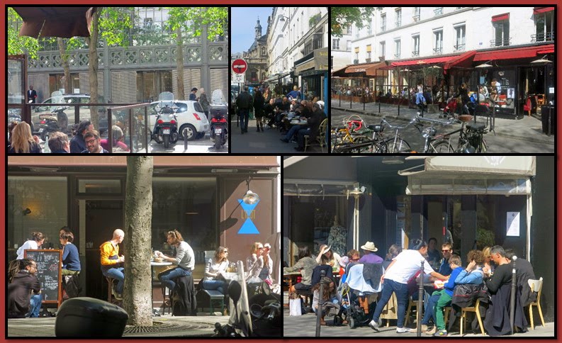
The area is getting more and more attractive for strolling around, with a great number of cafés, restaurants, art galleries, libraries, flower shops…


In one of the courtyards I found this beautiful and very alert cat. 


31.3.14

Carreau du Temple


“Carreau du Temple” was one of the covered market places in Paris, constructed in 1863, typical for those days in brick, steel and glass, then replacing a wooden structure. I wrote about the place in a post some five years ago and then took these pictures.


The market which specialised in clothes and textiles was originally three times bigger. It lost in importance and after some abandoned plans to have it replaced by a parking space, it was a few years ago decided to transform the place to a centre for basically cultural and sport activities. The transformation is now more or less completed, a first part opened to public in February, used for exhibitions, fashion shows and similar events. The other part, including an auditorium will open late April.


Last weekend I visited the art exhibition “Drawing Now”. A large number of international galleries and artists exposed. A lot to see…


My attention was especially drawn to “Ben”, easily recognised for a famous wall painting in Paris, rue de Belleville (see previous post) and by the Belgian cartoonist, Philippe Geluck.


Part of the exhibition was to be found on a lower level, newly created...  


… and a further part in another space, “Espace Commines”, previously an 19th century industrial locale.


I ran into Mme Anne Hidalgo, who the following day (yesterday) was elected the new mayor of Paris.


I will revert to more views from the area around the “Temple”, full of history (see previous posts), now becoming more and more attractive. 

27.3.14

Treves, Trier, Trèves, Augusta Treverorum...


The last day of my visit to Luxembourg blogger friends Léia and Cezar brought me to Treves (Trier, Trèves) in nearby Germany.

To go there, you will cross and again meet the Mosel River, known for its Riesling wines (which we of course tasted).


As you can read on one of the beautiful buildings in Treves - “Ante Roman Treviris Stetit Annis Mille Trecentis..." -, the city existed already (at least) 13 centuries before the Romans founded the “Augusta Treverorum” (referring to the Celtic tribe of Treveri) during the reign of Augustus, the first Roman Emperor, 16 BC. It may be the oldest city in Germany and it was for a while the largest European city north of the Alps, seat of the Gallic Prefecture. It became Frankish during the 5th century. The Vikings sacked the city during the 9th century. In 902 it passed in the hands of archbishops and the Archbishop of Treves was one of the seven Electors of the Holy Roman Empire. The French took over the place for long periods during the 17th, 18th and 19th centuries, but after Napoleon’s defeat 1814-15, the city was proclaimed part of the Kingdom of Prussia. (Karl Marx was born here in 1818.) After the unification of the different German states in 1871, Treves joined the German Empire, Germany.

There are a number of Roman buildings left. One of them, the “Porta Nigra”, built 168-200 AD, the remaining one of originally four Roman city gates, can be seen at one end of the Simeonstrasse, the main central street surrounded by a number of beautiful buildings, at the other end leading to the Hauptmarkt and the 15th century St.Gangolf Church. (Please note the red circle I added on one photo. This was originally the entrance to this year-1230 building, originally reached by some wooden stairs, which could be withdrawn in case of danger.)


The Cathedral of Treves is the oldest one in Germany with some parts from the end of the 10th century with a number romanesque, gothic and baroque additions. It’s linked to the gothic Liebfrauenkirche.


Behind the rococo Electoral Palace you may on my photo vaguely see an angle of the Aula Palatina (or the Basilica of Constantine), another Roman building, from the 4th century, today under restoration. Another Roman remaining building is the Roman Baths. There are other Roman monuments to be seen, including a 2nd century bridge, but during a visit of a few hours…


We saw a group of young dancers, recording what probably soon may be found on YouTube - a Treves version of Pharrell Williams’ “Happy”.  


A little addendum from yesterday evening.... The Chinese President is visiting Paris.

24.3.14

Luxembourg (Vianden)


Blogger friends Léia and Cezar kindly brought me to the northeast of Luxembourg - actually a drive of only some 50 km (30 miles) in this modestly sized country - to the little city and the castle of Vianden.
  
Built on the site of a Roman castellum, later a Carolingian refuge, the castle has 10th century origins and later got some gothic and renaissance transformations. The Counts of Vianden were ancestors to the House of Orange-Nassau, meaning linked to most of the European royal families, more especially to the Dutch and Luxembourgish ones. More or less abandoned, the castle was in 1820 sold to be dismantled, but it was soon bought back and partly saved, finally donated to the State in 1977 and since then completely restored.


The castle stands high over the charming little village, actually officially a city, and the river Our.


Close to a bridge you may be surprised to find the bust of Victor Hugo, by Rodin. The reason is that Victor Hugo made several tourist visits to the place and actually spent several months here in 1871, during his totally more than 20 years’ exile. He worked, wrote and even made several drawings and paintings, including the below one of the castle, then in ruins. You can visit the house where he lived, now a museum. 


20.3.14

Luxembourg (city)


It’s nice to have blogger friends! Last weekend I was invited by “Luna Snowshoe” and her “parents”, Léia and Cezar, to stay with them and visit Luxembourg. They really did the maximum to make the stay extremely nice, despite a bit cool and grey weather.


They of course took me around the City of Luxembourg, but we also made some excursions on which I will revert in later posts.

The Grand Duchy of Luxembourg, surrounded by Belgium, Germany and France, has some 525.000 inhabitants, whereof some 160.000 live in the capital – with suburbs. Three official languages are spoken: French, German and Luxembourgish. The country has a long history due to its central strategic location, starting with the Romans, and has been under Holy Roman Empire, Burgundian, Spanish, Austrian, French, Prussian domination until it really got its independence by the end of the 19th century. It was occupied by the Germans during the WWI and WWII.

Today it’s said to have the world’s second highest GDP per capita (after Quatar). The City of Luxembourg houses the Europoean Investment Bank and a number of European instiutions, offices, banks…

The original city installations were on the top of a cliff, surrounded by some extreme fortifications, which since to its largest extent have been destroyed, and by the narrow valleys of the rivers Alzette and Pétrusse. Today it’s a city on several levels with a large number of bridges and viaducts.

Here are first some views from the “Grund”, down in the valley…


… and some views from the upward walking (seeing the little 13th century “Quirinius Chapel) to the original city centre – the “Ville Haute” - where we can find some of the symbols of the city, the “Gëlle Fra” (Golden Lady) dedicated to the thousands of Luxembourgers who volunteered during WWI, and an inscription on a house reading “Mir wëlle bleiwe wat mir sinn” (We want to remain what we are), the national motto…


… and some views from the top, with the Ducal Palace, the Notre-Dame Cathedral…


…. and finally some views from the modern quarters, Kirchberg, with its offices, museums and a great concert hall, “Philharmonie”.